


Transportation planners are under growing pressure to make decisions that are both efficient and forward thinking. From reducing congestion to improving safety and sustainability, the demand for accurate, real-time data is increasing.
With a robust suite of location tools and data services, INRIX empowers transportation professionals to start planning with precision. Here’s how INRIX supports smarter infrastructure planning, traffic operations, and policy development.
Data Collection and Analysis
INRIX collects vast amounts of data from connected vehicles, GPS devices, and mobile apps. This data is anonymized and aggregated to provide insights into traffic patterns, vehicle speeds, travel times, and congestion hotspots.
For transportation planners, this means instant access to accurate insights into:
- Traffic volume and congestion hotspots
- Vehicle speeds and travel times
- Trip origin-destination patterns
- Modal shifts and commuter behaviors
This data eliminates the need for costly, static traffic counts and enables more responsive, evidence-based planning.
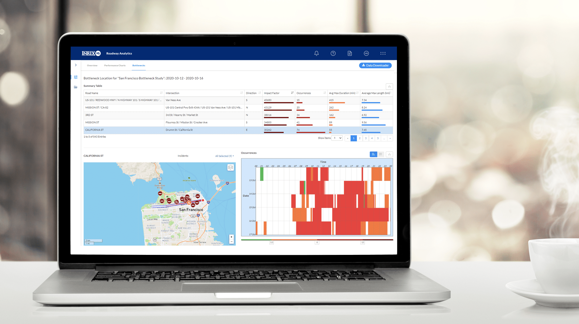
INRIX Roadway Analytics is a powerful tool that helps planners:
- Identify and Prioritize Congestion Areas: Pinpoint locations with recurring congestion and prioritize them for improvement
- Visualize Data: Create line and bar graphs to communicate findings effectively
- Economic Impact Analysis: Assess the economic impact of delays and congestion on specific roadways
Performance Monitoring
INRIX IQ provides real-time and historical data to monitor roadway performance. Planners can:
- Benchmark Performance: Compare current performance against historical data to identify trends
- Evaluate Interventions: Measure the effectiveness of traffic management strategies and infrastructure improvements
Safety Analysis
Our safety offering integrates crash data, vehicle speeds, and traffic volumes to help planners:
- Assess Risk Factors: Identify high-risk areas and prioritize safety interventions
- Evaluate Safety Projects: Monitor the impact of safety projects in near real-time
- Publish Roadway Conditions: Share real-time traffic conditions with the public
Use Cases for Planners
- Metropolitan Planning Organizations (MPOs): Model regional travel demand and inform TIP/STIP prioritization
- Departments of Transportation (DOTs): Evaluate congestion mitigation efforts and optimize traffic signal timing
- City Planners: Analyze mode shifts and plan for multimodal infrastructure
- Consulting Firms: Deliver client-ready analyses backed by data
INRIX brings agility, scale, and accuracy to every phase of the planning process — from visioning to implementation. If you’re looking to streamline your planning workflows, improve public trust, and drive better outcomes, INRIX can help. Learn more at inrix.com.