


With a unique set of in-depth analytical tools, INRIX Smart Highways allows public agencies to benchmark and improve roadway performance and maximize their investment of public funds. Public agencies and consultants use INRIX global traffic data to more effectively monitor, measure and manage the performance of road networks.
Through comprehensive national and regional datasets, tools for managing highway congestion and emergencies, and the most thorough coverage in North America and Europe, INRIX is leading the industry in powering smart highways globally.
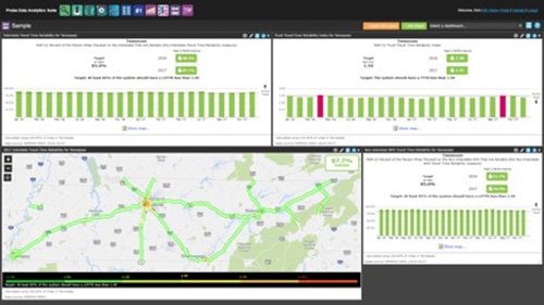
INRIX Provides NPMRDS to FHWA & State DOTs
INRIX supplies the core National Performance Management Research Data Set (NPMRDS), the default dataset for calculating the new US Federal ‘PM3’ system and freight performance measures. All state departments of transportation and metropolitan planning organizations can use INRIX travel time data to establish performance targets and report on progress. NPMRDS provides comprehensive and consistent data for passenger and commercial freight roadway performance across the National Highway System, as well as over 25 key Canadian and Mexican border crossings.
“We are proud to supply the underlying traffic data that will be used to monitor, measure and improve many of our nation’s key roadways,” said Scott Sedlik, vice president and general manager – global public sector at INRIX. “This federal win is further proof of the breadth and quality of our world-class traffic services.”
INRIX has partnered with the Center for Advanced Transportation Technology Laboratory (CATT Lab) at the University of Maryland and other industry leaders to support NPMRDS through 2022. As the prime contractor, CATT Lab will operate the portal that transportation planners will use to analyze, visualize and understand road performance.
“INRIX real-time traffic services will help public agencies actively measure, report and manage traffic,” said CATT Lab Director Michael Pack. “The quality of the data plays a fundamental and necessary role in NPMRDS to accurately assess our nation’s roadways.”
INRIX Tools Help Manage Congestion and Emergencies on Highways
INRIX technology and services enhance Highway Agency’s capability to collect data about traffic conditions, plan and manage current events. INRIX provides real-time traffic data as well as standard and custom APIs developed specifically for the needs of Highways Agencies.
By processing this data agencies can get a real-time view of traffic conditions on the motorway and trunk road network, assess the impact of events and traffic flows so that the operations staff can determine the most appropriate response and implement responses into action, including the dynamic signing of traffic diversions.
Agencies can publish this traffic and event information to websites, provide real-time traffic information to the travel news media for broadcast on national and regional radio and television and provide information to other organizations to assess the overall performance of the strategic road network.
HELP is on the way
HELP (Highway Emergency Link Platform) by ILog and INRIX uses FEMA’s wireless emergency alerting system to facilitate two-way communications with travelers trapped in traffic jams. Using HELP, Transportation Agencies can send an alert to mobile phones in the incident area and allow response teams to communicate via automated phone call or text message directly with motorists, giving emergency crews a clearer picture of the scale of the problems faced, and providing a systematic way to generate after action reports for post-event analysis.
INRIX Highway Traffic Information for Europe
INRIX is focused on improving the overall quality of traffic information in Europe by providing its unique method of mining and aggregating data from a combination of intelligent sources. These data sources include GPS-enabled commercial and consumer vehicles, data collected anonymously from mobile phones, traditional road sensor information, and cellular GPS data. This far reaching data aggregation results in highly accurate road speeds and comprehensive market coverage.
“Using INRIX data helps us to solve problems that were not possible to tackle in the past. With a high degree of accurate data coverage on strategic road networks as well as urban roads, we have a better understanding of traffic flow and the measures that can be taken to alleviate the impact of congestion.” Dr. Joachim Wahle – CEO TraffGo Road GMBH