


When hurricanes occur, they pose a serious threat to transportation infrastructure; with heavy rain, powerful winds, and widespread flooding damaging roads, bridges, and power lines. These disruptions can isolate communities and hinder emergency response efforts. In such high-stakes situations, safe and efficient navigation becomes critical, making real-time, accurate information on road conditions essential.
Drivers often depend on satellite navigation systems during storms, but outdated or incorrect data can steer them directly into danger. Access to timely and reliable updates on road closures and hazards is vital—not only for public safety, but also for coordinating emergency situations. After a storm, when the landscape has often been dramatically altered, accurate information helps first responders quickly adapt and operate effectively in the unstable environment.
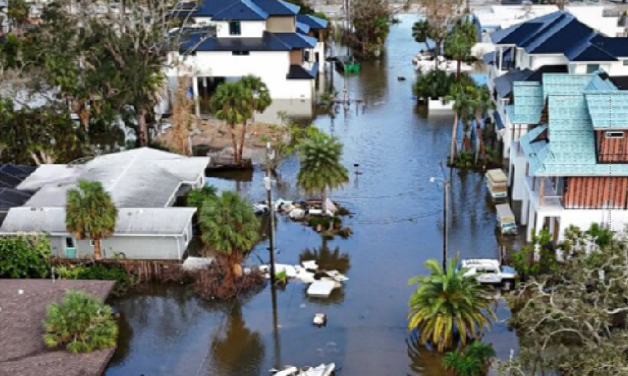
In October 2024, Hurricane Milton, a Category 4 storm, became the second hurricane to strike Florida’s Gulf Coast in just 13 days, delivering a devasting blow to the already ravaged Tampa Bay area. The storm unleashed unprecedented rainfall, qualifying as a 1-in-1,000 – year event. St. Petersburg alone recorded 18.31 inches of rain – more than 1.5 feet – in a single 24-hour period, as reported by the National Weather Service. Even more alarming, 5.09 inches of that rainfall fell within a single hour, from 8 p.m. to 9 p.m. ET- an event with just a 0.1% likelihood of happening in any given year. The magnitude and intensity of this storm underscore the exceptional and historic nature of the disaster.
Tracking Hurricane Milton
One of the ways that INRIX contributes to managing the chaos hurricanes bring is through our powerful Incident Data, designed to provide real-time information on road closures and hazards. INRIX recorded over 500 incidents related to Hurricane Milton, including:
- 347 flooded roads
- 91 fallen trees
- 63 downed power lines
- Numerous cases of damaged roads, mudslides, and controlled closures.
Throughout the storm, INRIX delivered up-to-date reporting on major interstate closures, applying rigorous attention to ensure the accuracy of both the length and status of each closure. INRIX reported on the closures of 10 major bridges surrounding the area. Accurate closure information is not just about convenience but can be the difference between safety and danger for drivers navigating hazardous, flood-affected roads.
INRIX Incident Data is invaluable for emergency responders, relief workers, and people who must navigate disaster-stricken areas to ensure the safety of their routes. Using a three-prong approach; real-time GPS probe data, online source curation, and social media monitoring, allows INRIX to provide drivers with up-to-the-minute information on which roads are safe during a storm. Incident Data helps emergency crews act quickly and with confidence:
- Evacuate communities
- Deliver essential supplies
- Coordinate rescue missions
Behind the scenes of Incident Data is the INRIX Incident Team which plays a critical role in keeping the data accurate and up to date. This dedicated team works around the clock – 24 hours a day, seven days a week –closely monitoring conditions, and continuously updating road closure reports. Using advanced tools and methodologies like GPS probe data and artificial intelligence, they ensure that drivers and emergency responders have access to the most precise and reliable information.
Supporting Emergency and Relief Efforts
INRIX Incident Data also plays a pivotal role for companies managing shipments or aid deliveries. Natural disasters cause significant delays in supply chains, and companies must ensure their deliveries arrive safely at their destinations despite road closures and hazardous conditions. INRIX’s data helps logistics managers reroute shipments as necessary, reducing the risks associated with navigating hurricane-affected areas.
One of the standout features of INRIX’s service is its use of the Matthews Correlation Coefficient (MCC) to ensure balanced accuracy in its reporting. MCC considers not only true positives (roads that are closed and accurately reported as such) but also true negatives (roads that are open and identified correctly). By avoiding false positives (roads that are incorrectly reported as closed) and false negatives (roads that are closed but wrongly identified as open), INRIX ensures both emergency responders and everyday drivers have the most reliable navigation information available.
Assisting with Disaster Relief Efforts
The ability to effectively navigate natural disasters is becoming an essential part of disaster preparedness and response. INRIX continues to advance its incident data capabilities to deliver proactive disaster management efforts. By detecting hazardous conditions in real time and enabling both responders and drivers to steer clear of danger, INRIX’s focus on precision and dependability is crucial for maintaining safe and efficient transportation during hurricanes and other natural disasters.
In critical moments where every second matters, INRIX plays a key role in keeping people and goods moving safely. Whether you’re an emergency responder trying to reach affected areas or a logistics coordinator working to reroute vital deliveries, INRIX is there to help navigate through the chaos.